

The beginning of the hike is always the toughest, or at least that’s where I get the most winded and my muscles fatigue. I think of it as the warm-up section. And usually I’m prepared for the little discomfort. The warm-up section at Scotchman’s Peak, however, has caught me off guard. The first section of trail—maybe a quarter mile—is so steep that my calves burn out and I’m stopping to rest them every 20-or-so steps. I’m wondering how I’ll ever make it to the top. Wondering if it will be worth it. If I’ll be able to walk the next day. As a young man I’d sought mountain solitude in my search for peace. But today I’m not here for peace. Today, I’m here for victory, and so I push on.
Per the aforementioned label, it doesn’t take long (especially considering the grade of the trail) for the body to warm into it. Muscles become more pliable, lungs begin to perform more efficiently, heart rate balances out and blood begins to flow where it’s needed. Breaks come with less frequency. Movement becomes more natural. I begin to feel like I belong out here, reaching the peak feels possible again.
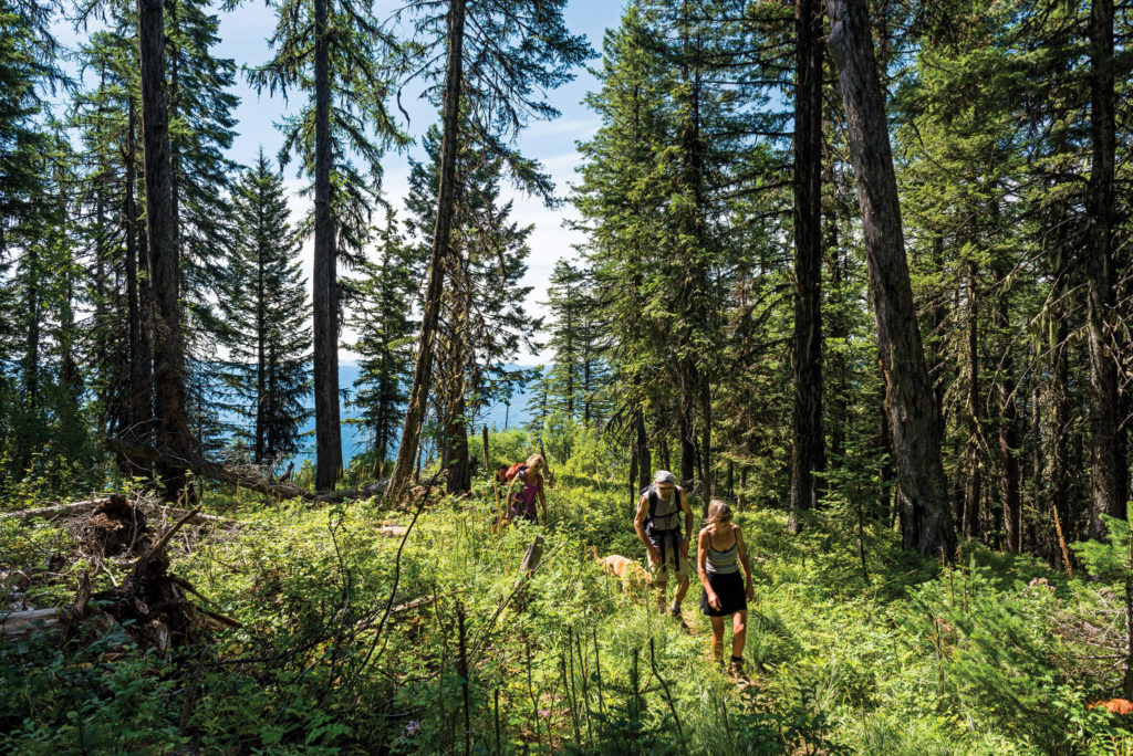
It’s not too long before the slope of the trail becomes more gradual. I feel less inclined to bear crawl up the path and more inspired to take in my surroundings. The trail begins in a dense, damp forest common in North Idaho. Here there are aged cedars and thick foliage. Much of the ground is covered with a heavy blanket of dark green moss. The air is close here, saturated with the scent of rich soil and fresh mountain water. It’s quiet in these woods. Even the breeze is soft. I squint off through the trees and undergrowth half expecting I’ll spot a lone moose, its rich brown hide nearly invisible against the shadows and wooded backdrop.
As I climb, the trees thin out, turning more and more to the silvery, slender trunks of high mountain timber. These storm-tested warriors of the wilderness with their iron like roots and scraggly low branches wear their few green needles like a badge. Like a protest, as if challenging Nature herself to come back and do her worst. Up ahead the trees give way to a meadow of thick bear grass. Beside me, on either side of the trail, huckleberry bushes droop with the burden of ripe fruit. I’ll be sure to stop here on the way back. I eat a few berries and continue up the trail.
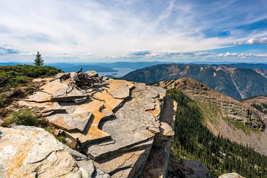
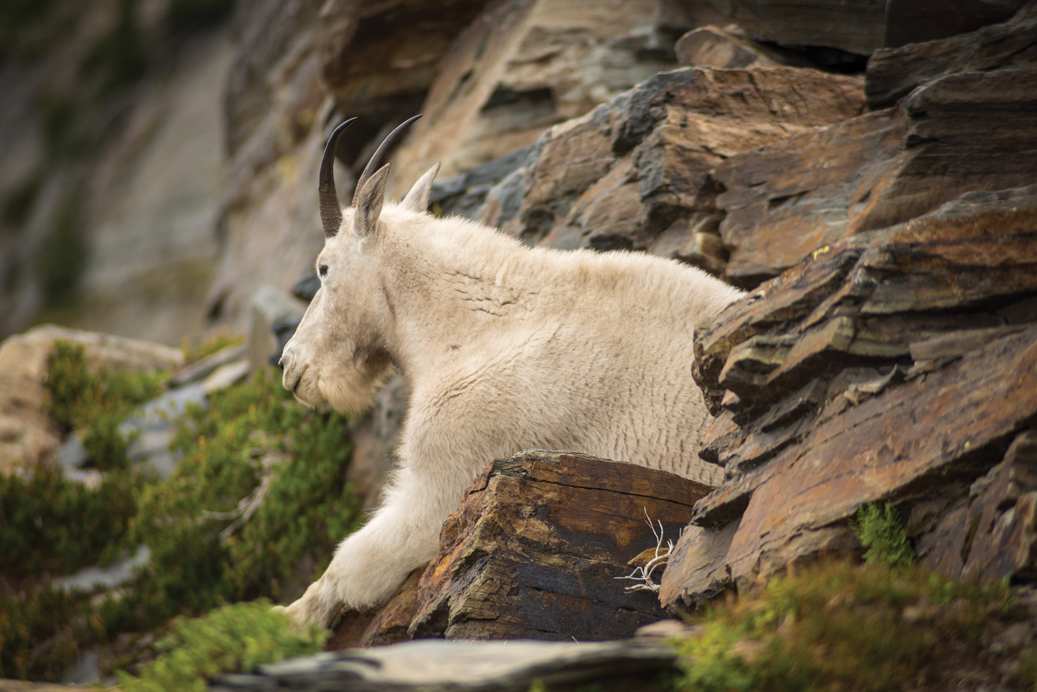
The timber gets thinner and thinner the higher I climb, until there are almost no trees at all and the ground is covered entirely with rocks and bear grass. It’s a beautiful contrast. Above me all else gives way to boulder fields and the craggy summit of Scotchman’s Peak. I’m careful to give a shaggy but muscular mountain goat plenty of space as I follow the narrow footpath that takes me to the actual peak.
WHO COME TO THE TOPS OF THE MOUNTAINS CALL THIS ‘GOD’S COUNTRY.’
With arms outstretched to receive the updraft rising from the valley far below, I slowly turn, taking in all I see. To the west the sky is reflected off the waters of Lake Pend Oreille. To the north, south and east are mountains as far as I can see. The sense of accomplishment, of victory, I had anticipated is as nothing compared to another feeling I’d become so familiar with in my youth. Peace. And I’m reminded why so many who come to the tops of the mountains call this ‘God’s country.’
Out there to the west, rise majestic, rocky peaks, crystal blue alpine lakes, even several small fields of glacial ice. Scotchman’s is magnificent, but out there is true wilderness. True adventure, and I realize then, I want it. It’s as if Scotchman’s Peak is simply the gateway to the Cabinet Mountain Wilderness. It’s like drinking milk when what you want is something much stronger.
The wind having chilled me significantly, I decide to run the trail back in order to warm up a bit. I quickly reach the huckleberry patch and decide it’s a good time for another break. I step off the trail and find a good spot where I can stretch out in the midst of the heavy laden bushes. I eat my fi ll of berries, sucking them straight off the plant; no hands necessary. Then, I stretch out, a mossy log for a pillow, and catch a quick nap before making my way back down to the world of mortals. N
Scotchman’s Peak Trail #65
- Take Highway 200 to Clark Fork, Idaho then turn north at the Chevron Station onto Main Street.
- Follow this road past Clark Fork High School, and then around a bend to the right. At the intersection with Lightning Creek Road, set your trip odometer to 0. (Don’t turn here; keep going straight on Mosquito Creek Road.)
- At 0.6 miles, keep left at
- the fork.
- At 2.1 miles, turn right on
- FR 2295. (There won’t be a sign marking it as FR 2295. It’s marked as such on the map. You’ll know you’re heading into the right neighborhood when you pass the sign telling you you’re entering grizzly bear habitat.)
- At 3.1 miles, turn left onto FR 2294. (Again, there won’t be
- a sign marking it as FR 2294. You’ll see a small sign pointing toward Trail 65.)
- At mile 3.6, turn left on FR 2294A. (And, yet again, there won’t be a sign marking it as FR 2294A. Again, you’ll see a small sign pointing toward Trail 65.)
- Follow FR 2294A for 2.2 more miles to the end of the road, where you’ll find the trail head.
- Look up.
By Toby Reynolds
Photography By Joel Riner